ABOUT:
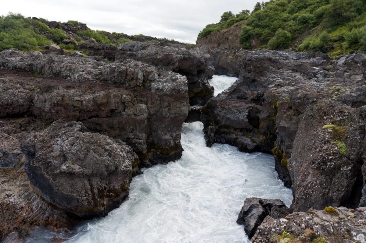
Barnafoss is a beautiful waterfall located on the Hvitá river. Barnafoss is also next to its sister waterfall Hraunfossar, though the two cannot be more different. While technically a waterfall, Barnafoss acts more like a series of rapids that rushes through the bedrock on the edge of the Hallmundarhraun lava field. At one point in time, a natural bridge stretched over the waterfall, but it has been lost to time.
Barnafoss is the official name, but it is also known as a Barnafossar or Bjarnafoss. The name Barnafoss translates as “the Children’s Fall.”
History:
Barnafoss, being “the Children’s Fall,” shares a darker meaning according to legend. The tale tells the story of a family with two boys who lived at the Hraunsás farm. One day, the parents left for church, and the boys decided to follow them. To catch up, they decided to take a shortcut to the church over a stone bridge above Barnafoss. The boys didn’t make it across the bridge and fell into the raging waters below to their deaths. Rightfully so, the parents were distraught, with the mother bordering insanity. One tale describes her demanding the bridge be torn down, while the other describes her placing a curse on the bridge to cause other travelers to drown if they tried to cross it. Fortunately, the bridge is no longer there and was lost either by natural causes or perhaps it was destroyed after a terrible accident.
hiking:

Length: 0.5 mi (0.8 km)
Elevation gain: 72 ft (8 m)
Route Type: Loop
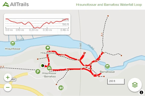
AllTrails list the “Hraunofossar and Barnafoss Waterfall Loop” trail, an easy hike to see both waterfalls. The path is a well-maintained pathway and includes a bridge over the Hvitá river. The hike to see both waterfalls is a short walk of 0.5 mi (0.8 km). It roughly takes around 13 minutes to complete this hike. This hike is family-friendly and reportedly accessible during winter conditions.
Directions:
Viewable from Road?: No
Nearest Town: Reykholt
Distance from Reykjavík: 78 mi (126 km)
Barnafoss is listed on Google Maps and is around a 1 hr and 42 min drive from Reykjavík. There a no major town near this area, but the village of Reykholt has a gas station within the region. However, Barnafoss is perfectly accessible within a day trip from Reykjavík.
From Reykjavík, head north on the Ring Road (Vesturlandsvegur / Route 1). As the road goes around and under the bays, stay on Route 1 until you reach Borgarfjarðarbraut (Route 50 ). Continue down this route until you reach Hálsasveitarvegur (Route 518). Follow Hálsasveitarvegur until you reach Barnafossvegur (Route 552), where you will be practically at the waterfalls’ parking lot.

