ABOUT:
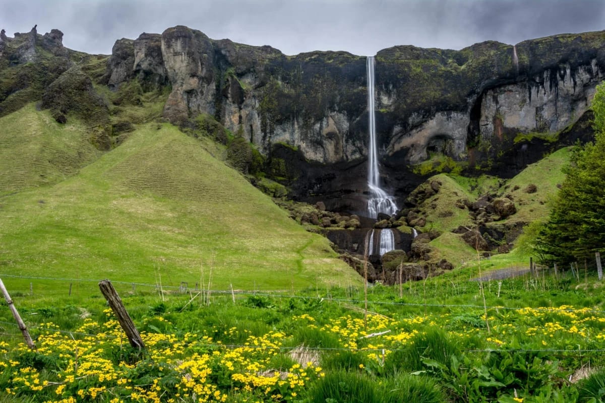
Foss á Síðu is a commonly seen waterfall that is frequently passed. This waterfall is located in the Southern Region and is viewable from the Ring Road (Route 1). Foss á Síðu is not a mighty waterfall, but its slender cascade against the dark cliffside and vivid greenery makes it truly beautiful. Many would be surprised to learn that Foss á Síðu is Iceland’s 14th tallest waterfall.
Foss á Síðu is fed by the Þórutjarnarlækur stream, which originates from a small lake called Þórutjörn. The water flow can be so thin that Foss á Síðu becomes one of Iceland’s upside-down waterfalls on a windy day. The winds against the cliffside are strong enough to carry the mist from Foss á Síðu back upwards. Other days Foss á Síðu can virtually disappear.
The name Foss á Síðu means “Waterfall at Síða,” Síða being the district from Skaftá to Þverá. Local farmhouses surround Foss á Síðu, but they expect visitors. There is no official parking to view the Foss á Síðu, but there is room to pull over in one of the driveways for a quick photo. One farmhouse has even opened up a cafe called Hamrafoss Cafe. This little cafe offers plenty of scenic views while you get some local treats.
History:
The land surrounding Foss á Síðu has been inhabited since between 874 and 930 AD, and this timeframe is known as the Iceland Settlement Area. One of Iceland’s oldest literature pieces, the Book of Settlement, directly mentions Foss á Síðu.
Of course, being such an old historic area, Foss á Síðu comes with legends and folklore. A story that goes back to the 16th century tells the tale of a man cursed for his wicked deeds. He and his family were haunted by a dog named Móri. This canine specter supposedly haunted this family for nine generations. Móri is also still reported to be seen in the area.
The source of Foss á Síðu, lake Þórutjörn, also has its own legend. It is said that a working woman named Þóra was tricked by a Nykur, a horse-like amphibian. Nykurs were known to lure wandering passersby into mounting it. Once mounted, the victims are then dragged into their watery graves. Unfortunately, this was the alleged fate of Þóra.
Just right down the road from Foss á Síðu is Dverghamrar, which translates to “Dwarf Rocks” or “Dwarf Hammers.” As the name suggests, this area was believed to be the home of Dwarves. Regardless, Dverghamrar is a stunning and unique feature. It is believed these rocks were formed as waves crashed into molten lava.
hiking:
As mentioned before, Foss á Síðu is located on private farmland, so there are no hiking trails to the waterfall. However, Foss á Síðu is perfectly viewable from the car. There are reports of a trail nearby the area that leads up to the lake Þórutjörn. It is also reported to have a beautiful view of the Síða.
Directions:
Viewable from Road?: Yes
Nearest Major Town or City: Vik
Distance from Reykjavík: 174 mi / 280 km
Foss á Síðu is a little over a three and half hour drive from Reykjavík, and it is only around an hour from Vik. Foss á Síðu is viewable from the Ring Road and easily found on Google Maps. While many pass by Foss á Síðu, its beauty is worth the quick stop.

