ABOUT Stigafoss:
Location: Southern Region
Height: 450 ft (137 m)
River: Fossagil
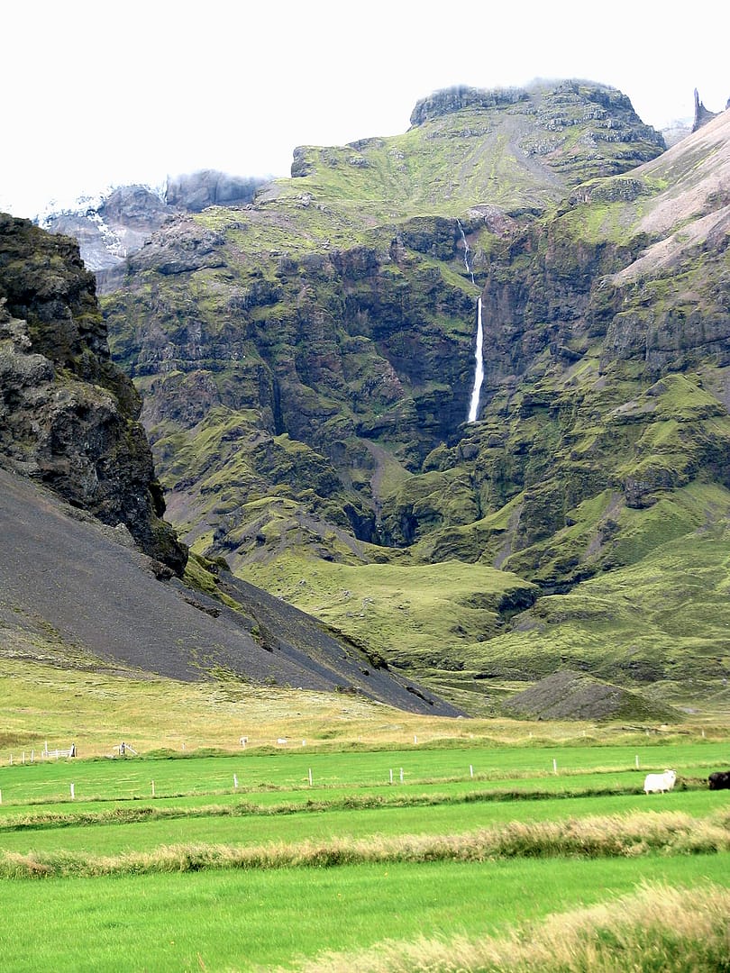
Stigafoss, also called Stigárfoss, is passed by every day. Despite being in plain sight and a beautiful waterfall, it’s hardly ever considered one of the tallest waterfalls in Iceland. Yet it is Iceland’s 5th tallest waterfall, according to our list. You may come across some information that suggests it as the third tallest waterfall, but either wall is truly a hidden gem.
Stigafoss, when translated to English, means Staircase Falls. Stigafoss is known for its significant drop from the cliffside that can be seen from a distance. Leading up to the cliff is a large jagged rock formation and a smaller series of falls, perhaps earning the name “Staircase.”
You can see Stigafoss from the Ring Road, but no maintained roads or trails lead to the waterfall. You can find Stigafoss on the eastern side of Iceland, between Skaftafell and the Glacial lagoon.
Stigafoss is fed by the Fossagil stream, which is sourced from the icecap melts of the Öraefajökull Volcano. This is the largest active volcano in Iceland, and in fact, Stigafoss sits on the southern tip of the volcano.
History of Stigafoss:
Unfortunately, we do not have data on the history or folklore surrounding Stigafoss. We will update this as soon as we can. If you would like to submit any information, please email us at [email protected].
hiking to Stigafoss:
There appear to be no visible trails leading to Stigafoss. There are a few pictures online to suggest people have made the hike, but the distance from the road is quite far, and it’s unknown how dangerous it is to get near the waterfall. Below is a clip of a drone traveling to Stigafoss from a distance. You can see what appears to be some evidence of tire tracks, but even those don’t seem to get too close to Stigafoss.
Directions to Stigafoss:
As of writing this, Google has the incorrect location for Stigafoss. To get there by car, you will want to head to 63.932500, -16.598333 on Google Maps. The drive is nearly 4 hours and 45 minutes from Reykjavík, but it is entirely on Ring Road (Route 1).

